Puerto Natales, Chile: Self-Guided Walking Tour
Things to do in Puerto Natales
Puerto Natales is a small city of about twenty thousand inhabitants situated at the edge of Chilean Patagonia where the mountains meet the sea, serving as the gateway to Torres del Paine National Park and offering a blend of frontier history, Patagonian atmosphere, and access to extraordinary natural sites. It is worth visiting for its own character—colorful buildings, waterfront views, the Milodón cave, and the historic Frigorífico Bories—before venturing farther into the wilderness. Neywo provides a free audio guide for Puerto Natales with 12 narrated places that you can explore at your own pace.
What to see in Puerto Natales
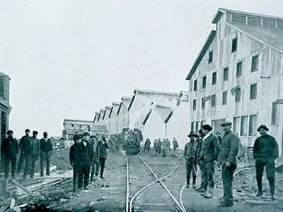
Frigorífico Bories
Frigorífico Bories is a former industrial plant in the locality of Puerto Bories that focused on producing food and products of animal origin. It was declared a Chilean National Monument in 1996 and lies within the Magallanes and Chilean Antarctic Region, marking an important heritage site for the area.
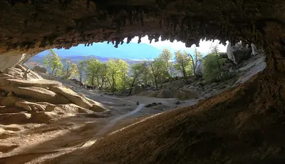
Cueva del Milodón Natural Monument
Cueva del Milodón Natural Monument lies about 24 km from Puerto Natales along the flanks of Cerro Benitez and comprises three caves and the Silla del Diablo rock formation. It is named after the milodón, a giant herbivorous mammal that became extinct near the end of the Pleistocene; in 1895 explorers found skin, bones and other remains of this ground sloth in one of the caves. The largest cave sits 150 m above sea level, measures roughly 30 m high, 80 m wide at the entrance and extends 200 m deep.
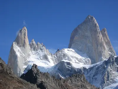
Mount Fitz Roy (Cerro Chaltén)
Mount Fitz Roy, known locally as Cerro Chaltén, rises over 3,000 m from the Southern Patagonian Ice Field on the Argentina‑Chile border. Its sheer granite spires and razor‑sharp ridges make it one of the world’s most technically difficult climbs, challenged by relentless wind and porous, unpredictable rock. The village of El Chaltén, established in the mid‑1980s, serves as the gateway, with a half‑day hike to the mountain’s base. The first confirmed summit was achieved in 1952 by French alpinists Lionel Terray and Guido Magnone.
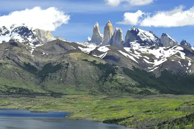
Torres del Paine National Park
Torres del Paine National Park covers more than 180,000 ha of mountains, glaciers, valleys and rivers in Chilean Patagonia. Its centrepiece is the Cordillera del Paine, featuring the three iconic granite towers—Torre d’Agostini, Torre Central and Torre Monzino—each rising about 2,500 m above sea level, flanked by the Cuernos del Paine with dark sedimentary caps. The park was first protected in 1959 after pressure from residents and visitors, and has since been expanded to its present size, safeguarding glaciers, turquoise lakes and the transition zone between Magellanic subpolar forests and Patagonian steppe.
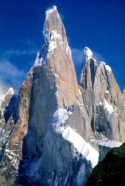
Cerro Torre
Cerro Torre is a distinctive peak on the Southern Patagonian Ice Field, also on the Argentina‑Chile border. It is notorious for the frequent build‑up of rime ice that forms a mushroom‑shaped cap over its summit due to strong, constant winds. Cerro Torre is the highest of a four‑peak chain that includes Torre Egger, Punta Herron and Cerro Standhardt. The claim of a first ascent by Cesare Maestri in 1959 remains unverified, as his partner Toni Egger died on the descent and later repetitions found no evidence of his climb.
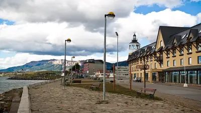
Puerto Natales
Puerto Natales, the capital of Última Esperanza Province, has roughly twenty thousand residents and lies on the Señoret Channel between the Gulf of Almirante Montt and Última Esperanza Sound. The city was formally founded on 31 May 1911 under President Ramón Barros Luco and has long been the last major stop before Torres del Paine National Park. Its waterfront and historic buildings reflect the sheep‑farming and maritime heritage that shaped the settlement, while the surrounding area was traditionally inhabited by the Kawésqar and Aoniken peoples.
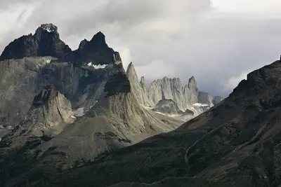
Cordillera del Paine
The Cordillera del Paine, also called the Paine Massif, lies about 150 km north of Puerto Natales. Its highest point reaches 2,818 m above sea level, while the famous Torres del Paine granite towers average around 2,600 m. The range stretches roughly 25 km east to west and includes summits such as Cerro Blanco, Cerro Paine, Cerro Paine Chico and Cerro Paine Medio. It has been celebrated internationally, being named the fifth most beautiful place in the world in a National Geographic special edition and later voted the eighth wonder of the world by Virtual Tourist.
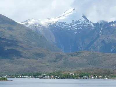
Wellington Island
Wellington Island is Chile’s third‑largest island, covering over 5,500 km² far to the south where the Pacific meets the Patagonian channels and directly faces the Southern Patagonian Ice Field. Almost the entire island lies within Bernardo O’Higgins National Park, presenting grassy expanses, rugged coastlines and a climate that averages about 1 °C year‑round. For roughly six‑thousand five‑hundred years the shores have been home to the Kawésqar people, skilled canoe nomads who navigated these channels long before any maps existed.
Bernardo O’Higgins National Park
Bernardo O’Higgins National Park is Chile’s largest protected area, extending across parts of the Aysén and Magallanes‑Antártica Chilena regions. It includes Lautaro Volcano, which rises to 3,623 m above sea level, and is named after General Bernardo O’Higgins, the first head of state of the Republic of Chile.
Lake Nordenskjöld
Lake Nordenskjöld, one of the lakes inside Torres del Paine National Park, lies in the Magallanes Region. Its western outflow forms the Salto Grande waterfall, and the southern shore of this end often hosts grazing guanacos. The lake’s average temperature is about 2 °C, with February the warmest month and July the coldest.
Lake Pehoé
Lake Pehoé stretches over twenty‑two square kilometres and lies roughly 145 km north of Puerto Natales in the Magallanes Region. It is fed mainly by the Paine River after it passes Nordenskjöld Lake, but receives water once the river plunges over the Salto Grande waterfall; additional inflow comes from Skottsberg Lake. Despite its mountainous setting, the lake sits at only about 34 m above sea level and measures approximately 6 km north‑south by 8 km east‑west.
Sarmiento Lake
Sarmiento Lake, also within Torres del Paine National Park, is noted for white thrombolite rings along its shoreline—microbial calcium carbonate deposits possibly fed by hydrothermal activity deep in the lake. It is named after the sixteenth‑century explorer Pedro Sarmiento de Gamboa and covers about ninety square kilometres at an elevation of roughly 75 m above sea level, measuring approximately 23 km east‑west by 9 km north‑south.
Explore Puerto Natales with Neywo
Neywo offers a free audio guide for Puerto Natales featuring 12 narrated places. The stories play automatically as you arrive at each site, allowing you to explore at your own pace with no group or fixed schedule. The guide is available in 11 languages. While the TOURS section does not list any specific walking, bus or bike routes, the audio guide itself provides a self‑guided way to discover the highlights described above.
Other Chilean destinations you might consider include Punta Arenas, Santiago, and Valparaíso. For broader context, see the Chile country page.
Places with an audio guide in Puerto Natales
8 places in Puerto Natales with a Neywo audio guide. Each one starts telling its story as you reach it.
Walk Puerto Natales with Neywo
Neywo turns Puerto Natales into a self-guided audio tour. Stories arrive as you reach the place they belong to, and the route reshapes when you wander off it.