What to See in Aguas Calientes, Peru: Free Audio Guide
Things to Do in Aguas Calientes: What to See Near Machu Picchu
Looking for things to do in Aguas Calientes? This small town, also known as Machupicchu Pueblo, is the gateway to Machu Picchu and a destination surrounded by steep mountains, tropical vegetation, and the Urubamba Valley. Its thermal baths and nearby Inca sites make it worth exploring beyond a visit to the famous citadel. Neywo has a free audio guide for Aguas Calientes with 10 narrated places, available in 11 languages.
What to See in Aguas Calientes
Machu Picchu
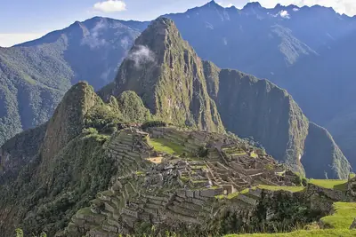
Machu Picchu is a 15th-century Inca citadel set high in the Peruvian Andes, at about 2,430 metres above sea level. It stands on a mountain ridge between Huayna Picchu and Machu Picchu, overlooking the Urubamba Valley and the river canyon below.
The site is a UNESCO World Heritage Site and is celebrated for its architecture and engineering. Although it is often described as a fortress or citadel, its exact role remains debated. Its finely built structures and ceremonial access route suggest that it may have been a religious sanctuary, while palaces and other functions may also have existed there.
The name Machu Picchu comes from Quechua and means “old peak”. The site was built in the classic Inca style, with carefully constructed stonework integrated into the mountain landscape.
Huayna Picchu
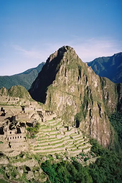
Huayna Picchu is the steep mountain rising behind Machu Picchu in many of the site’s best-known views. Its Quechua name, Wayna Pikchu, means “young peak”. The summit reaches 2,693 metres above sea level, around 260 metres higher than Machu Picchu.
The Incas built a trail up the mountain and constructed temples and terraces near its summit. On the mountainside, the Temple of the Moon and the Great Cavern are two important sacred structures, both known for their finely crafted masonry. Huayna Picchu also helps explain the dramatic setting of the citadel: the Urubamba River bends around the mountain below.
Wiñay Wayna
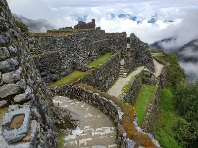
Wiñay Wayna is an Inca archaeological site along the Inca Trail to Machu Picchu, within the protected Historic Sanctuary of Machu Picchu. Its Quechua name means “forever young”.
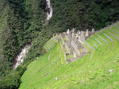
Built into a steep hillside at about 2,650 metres, the site overlooks the Urubamba River. Upper and lower house complexes are joined by a long staircase and a series of fountains. A shared water system once served both sections, and its channels remain visible.
Agricultural terraces, or andenes, surround the houses. Carved into the slope, they demonstrate how the Incas adapted steep mountain terrain for farming. A campsite nearby shares the site’s name and is commonly used as the final overnight stop before Machu Picchu on the classic Inca Trail.
Llaqtapata
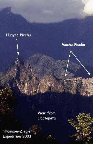
Llaqtapata is an Inca archaeological site on a ridge about five kilometres west of Machu Picchu. It stands between the Ahobamba and Santa Teresa drainages in the Santa Teresa District, above steep ravines.
The complex is relatively small, but its elevated position is its defining feature. From the site, there are direct views towards Machu Picchu and Huayna Picchu. Its walls include niches characteristic of Inca stonework, while the ridge setting suggests that Llaqtapata was closely connected to the surrounding network of settlements and sacred places.
Intipata
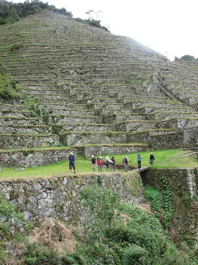
Intipata is an archaeological site in the hills of the Sacred Valley and one of the best-preserved groups of Inca terraces along the trail. Its stone terraces cascade down the hillside, showing how the Incas shaped mountain slopes for agriculture.
The terraces also helped manage water and limit erosion. Their precise stonework and continued condition make Intipata a striking example of Inca landscape engineering.
Sayacmarca
Sayacmarca sits at 3,600 metres above sea level in the mountains of the Cusco Region. The site is divided into a ceremonial sector and a residential area, with an entrance gateway and a large staircase leading through the complex.
Its irrigation system is one of its most notable features. Channels supplied water directly to the houses, demonstrating sophisticated hydraulic engineering at high altitude. Hiram Bingham III discovered the site in 1915 and initially called it Cedrobamba, meaning “cedar plain”, before it was renamed Sayacmarca.
The Inca Bridge
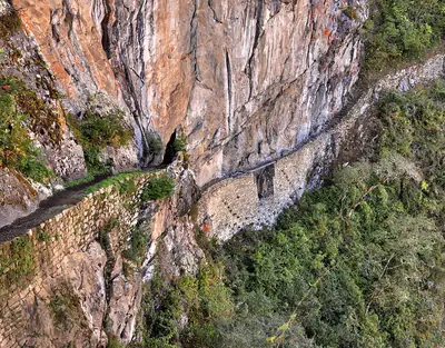
The Inca Bridge, also called the Inka Bridge or Puente Inka, is one of the features connected with access to Machu Picchu. One of the places known by this name was built by the Incas as a secret entrance to the sacred Picchu for the Inca army.
Its position illustrates how access routes formed part of the defensive and ceremonial landscape around the citadel.
The Inca Trail to Machu Picchu
The Inca Trail is one of the world’s best-known hiking routes. It crosses the Andes and ends at Machu Picchu, passing through cloud forest, alpine tundra, settlements, tunnels, and Inca ruins before reaching the Sun Gate.
The route consists of three overlapping options: Mollepata, the Classic route, and the One Day route. Mollepata is the longest and reaches the highest mountain pass before joining the Classic route. Together, these paths form part of the Qhapaq Ñan, the wider Inca road system that once connected the Inca Empire across the Andes.
Aguas Calientes and its Hot Springs
Aguas Calientes, or Machupicchu Pueblo, lies in a lush valley along the Vilcanota River, surrounded by steep mountains and dense tropical vegetation. Its name means “hot water” in Spanish, referring to the natural hot springs that give the town its relaxed, spa-like character.
The settlement is also the practical base for exploring Machu Picchu. Its compact atmosphere reflects its isolated location and its close connection with the archaeological sites and trails of the surrounding mountains. After a day focused on ruins and hiking, the thermal baths offer a different way to experience the landscape.
Runkuraqay
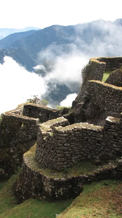
Runkuraqay is a mountain site on the Inca Trail, between Sayacmarca and Qunchamarka. It stands at 3,760 metres on the southern slope of the mountain of the same name, near the Runkuraqay pass.
Archaeologists identify it as a tambo, a rest and supply station for travellers, messengers, and chasquis—the relay runners of the Inca road system. Its semicircular buildings are made from slate and grey granite. Two concentric sloping walls enclose the inner chambers and a central courtyard, giving the structure a distinctive form.
Download the Neywo Audio Guide to Aguas Calientes
Neywo’s free Aguas Calientes audio guide includes 10 narrated places. The stories are available in 11 languages and play as you reach each location, at your own pace. There is no group and no schedule: simply explore independently while the app tells the story of the place in front of you.
Download Neywo to discover Aguas Calientes and its Inca heritage as you walk. You can also continue exploring the wider region with the guide to Cusco, or plan more of your trip through Peru.
Places with an audio guide in Aguas Calientes
8 places in Aguas Calientes with a Neywo audio guide. Each one starts telling its story as you reach it.
Walk Aguas Calientes with Neywo
Neywo turns Aguas Calientes into a self-guided audio tour. Stories arrive as you reach the place they belong to, and the route reshapes when you wander off it.