Things to Do in Sayulita, Mexico: Walking Guide
Things to Do in Sayulita, Mexico
Sayulita is a small coastal town in Nayarit, Mexico, within the municipality of Bahía de Banderas. Set between nearby hills, flatter ground and the Pacific coast, it is worth visiting for its relaxed seaside setting and access to the distinctive landscapes of the surrounding region. Neywo has a free audio guide for Sayulita with 20 narrated places, available in 11 languages.
What to See in Sayulita and the Surrounding Area
The most interesting things to do in Sayulita include exploring the town itself, discovering nearby settlements and looking out across the mountains, forest and coastal waters of Nayarit.
Sayulita
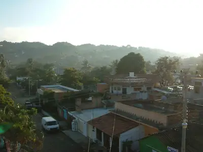
Sayulita is a small settlement in Mexico’s state of Nayarit, with the sea to the northwest and a landscape that combines hills with flatter ground. It has a population of about 2,262 people and offers a compact base from which to appreciate the coastal character of Bahía de Banderas.
Cerro El Caloso
Cerro El Caloso rises to about 540 metres above sea level in Bahía de Banderas municipality. The terrain around it is generally hillier to the northeast and flatter toward the southwest, where the sea is closest. A higher nearby point reaches about 586 metres and lies 2.1 kilometres north of the mountain.
Cerro Carelleros
Cerro Carelleros is a 123-metre hill in the municipality of Bahía de Banderas. The sea lies closest to the west, while the land becomes flatter to the south and hillier toward the northeast. The surrounding climate also changes significantly through the year: September is the wettest month, with about 341 millimetres of rainfall, while April is the driest, with about 1 millimetre.
Cerro el Pescado
Cerro el Pescado is a forested mountain rising to 880 metres above sea level. Tropical forest covers much of the surrounding area, which is relatively lightly populated. The mountain is about 1.3 kilometres wide at its base, and the nearest larger town mentioned here is Cándido Salazar, about 18.3 kilometres to the northwest.
Cerro El Cora
Cerro El Cora stands about 300 metres above sea level, approximately 104 metres higher than the land around it. Its base extends for about 0.84 kilometres, making it a clear natural feature within the hilly landscape near Sayulita.
Cerro El Hular
Cerro El Hular rises to 323 metres above sea level and stands about 52 metres above the surrounding terrain. Its base is approximately 0.95 kilometres across, offering another way to read the changes in elevation around the town.
Cerro La Bandera
Cerro La Bandera reaches 491 metres above sea level and rises about 62 metres above the nearby terrain. It forms a quiet natural landmark in a sparsely populated landscape within Bahía de Banderas municipality.
Cerro Las Piñas
Cerro Las Piñas is a hill that reaches 272 metres above sea level. It is one of the natural points of interest in the landscape around Sayulita, adding to the succession of hills and mountains beyond the coast.
Cerro Las Canoas
Cerro Las Canoas forms part of the Sierra Vallejo. The mountain reaches 719 metres above sea level and stands about 144 metres above the land around it. Its base extends for roughly 2.5 kilometres, giving it a broad presence in the regional landscape.
Cerro Vallejo
A little beyond Sayulita, Cerro Vallejo rises as part of the Sierra Vallejo. It reaches 1,133 metres above sea level and stands about 108 metres above the surrounding terrain. Its base extends for roughly 1.4 kilometres. The land around it is mostly hilly, becoming more mountainous toward the northwest.
Cerro Pátzcuaro
Cerro Pátzcuaro rises to 341 metres above sea level, approximately 188 metres above the surrounding terrain. Its base stretches for roughly two kilometres, and the mountain is surrounded mainly by tropical deciduous forest. Ravines are common in the wider region, while the highest nearby point reaches 491 metres about 3.5 kilometres to the southeast.
Marieta Islands
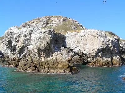
The Marieta Islands are a group of two small, uninhabited islands off Mexico’s Pacific coast in Nayarit: Isla Larga and Isla Redonda. Their idyllic appearance has made them a popular destination. The compact archipelago is surrounded by coastal waters reaching depths of roughly 20 to 30 metres.
Bucerías
Bucerías is another coastal settlement in Bahía de Banderas municipality. It lies about 16.7 kilometres southeast of Sayulita and provides a nearby point of comparison for the region’s coastal communities.
Valle de Banderas
Valle de Banderas serves as the municipal seat of Bahía de Banderas. The town lies at roughly 60 to 63 metres above sea level and has a population of about 7,666 people.
Colonia el Mirador
Colonia el Mirador is a settlement in the state of Nayarit and forms part of the municipality of Bahía de Banderas. It is one of the smaller communities that make up the area around Sayulita.
Mexico’s varied landscapes extend well beyond Nayarit. For more destinations across the country, see the Mexico guide. Travellers interested in mountain and forest scenery may also want to explore Pátzcuaro.
Explore Sayulita with Neywo
Neywo’s free Sayulita audio guide includes 20 narrated places. The app tells the story of each place as you reach it, at your own pace, with no group and no schedule. Narration is available in 11 languages, making it an easy way to explore the town and its surrounding landmarks independently.
Places with an audio guide in Sayulita
4 places in Sayulita with a Neywo audio guide. Each one starts telling its story as you reach it.

Walk Sayulita with Neywo
Neywo turns Sayulita into a self-guided audio tour. Stories arrive as you reach the place they belong to, and the route reshapes when you wander off it.