Visiting Courmayeur, Italy: Top Sights on Foot
Things to Do in Courmayeur: What to See in the Italian Alps
Courmayeur is an alpine town in Italy’s Aosta Valley, on the Italian side of Mont Blanc. Its historic centre, mountain museums, churches, valleys, and views of the Mont Blanc massif make it an excellent place to experience the Alps from an Italian perspective. Neywo has a free audio guide for Courmayeur with 8 narrated places, available in 11 languages.
What to See in Courmayeur
The best things to do in Courmayeur combine mountain scenery with the town’s religious, cultural, and engineering heritage. These are the places to look out for as you explore.
Mont Blanc and the Mont Blanc massif
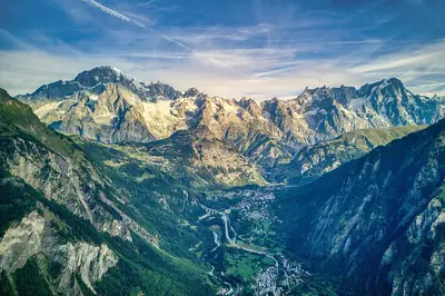
Mont Blanc, or Monte Bianco, is the defining landmark of Courmayeur. Rising to more than 4,800 metres, it is the highest mountain in the Alps and stands along the border between Italy and France. Its exact height varies because of changes in its snow cap.
The surrounding Mont Blanc massif is shared by France, Italy, and Switzerland. It contains eleven major independent summits above 4,000 metres, as well as glaciers, granite and gneiss peaks, and valleys shaped by high-altitude conditions. Mont Blanc was first climbed on 8 August 1786, an ascent often associated with the beginning of mountaineering.
The massif is also a setting for hiking, trail running, skiing, and snowboarding. A cable car crosses the range towards Chamonix through the Col du Géant, offering another connection between the Italian and French sides of the mountains.
Grandes Jorasses
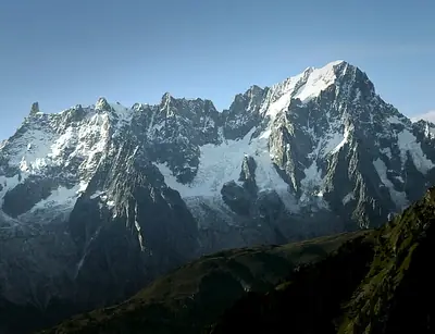
From Val Ferret, the Grandes Jorasses form one of the most impressive mountain groups in the Mont Blanc massif. Their granite peaks rise along the boundary between France and Italy, with the Italian side overlooking the valley.
The highest summit is Pointe Walker, at 4,208 metres. Other summits include Pointe Whymper, Pointe Croz, Pointe Hélène, Pointe Marguerite, and Pointe Young. The northern French face forms a granite wall about 1,000 metres high and almost 1,200 metres long. In the 1930s, it was considered one of the last great challenges in the Alps.
The climbing history of the group is equally notable. Pointe Whymper was first climbed in 1865, while Pointe Walker was first reached in 1868.
Duke of the Abruzzi Alpine Museum
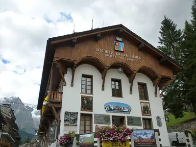
The Duke of the Abruzzi Alpine Museum, also known as the Museum of the Guides, explores the tradition of mountain guiding in Courmayeur. It is housed in the Casa delle Guide, home of the Courmayeur Alpine Guides Society.
The association was established in 1850 and is described as the oldest alpine guide association in Italy and the second oldest in the world. The museum provides a way to understand the people and profession behind the region’s mountaineering history.
Saint Pantaleon’s Church
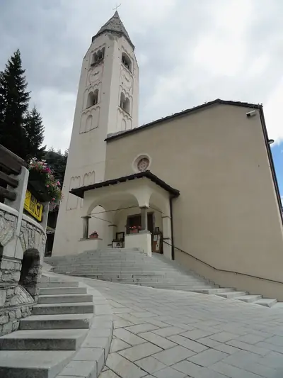
In the centre of Courmayeur, Saint Pantaleon’s Church stands in Piazza Abbé Henry. Known in Italian as Chiesa di San Pantaleone, it is the town’s principal Catholic place of worship.
The entrance faces towards the road to Villair, making the church an easy landmark to include while walking through the centre.
Notre-Dame-de-Guérison Sanctuary
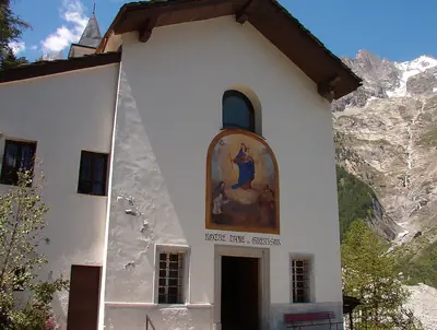
The Notre-Dame-de-Guérison Sanctuary, or Our Lady the Healer, lies at the entrance to Val Vény. The Christian sanctuary stands at the foot of Mont Chétif, facing the Brenva Glacier, and is surrounded by the mountain landscape.
It is located along the road through Val Vény towards the Seigne Pass. The route was used by the Romans to reach Gaul, while the sanctuary is now known for its setting and its proximity to Courmayeur.
Dora Baltea
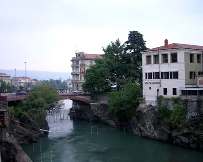
The Dora Baltea is one of the important rivers of northwestern Italy. It flows through the Aosta Valley and Piedmont before joining the Po as a left-bank tributary.
Noticing the river adds another dimension to Courmayeur’s landscape: the town is not only surrounded by peaks and glaciers but also connected to the wider river system of northern Italy.
Mont Blanc Tunnel
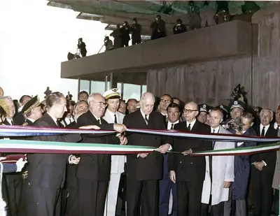
The Mont Blanc Tunnel connects Courmayeur with Chamonix beneath the Mont Blanc massif. Built jointly by France and Italy, construction began in 1957, drilling started in 1959, and the tunnel was completed in 1965. Traffic opened on 19 July of that year.
The passage stretches for 11.611 kilometres and consists of a single gallery with two lanes carrying traffic in opposite directions. Its gently inverted-V route supports ventilation and water drainage. The tunnel lies about 2,480 metres beneath the surface, directly below the Aiguille du Midi.
Its history also includes the serious consequences of the 1999 fire, which caused 39 deaths. Afterward, France and Italy placed operations under a single management entity jointly controlled by the two operating companies.
Courmayeur in the Aosta Valley
Courmayeur’s identity comes from its position between the Italian and French sides of the Alps. The Mont Blanc massif once provided communication routes used by the Romans, and local communities later maintained a peasant farming economy in the surrounding valleys. Wider interest in the mountains grew during the eighteenth century, as glaciers and peaks began attracting visitors and adventurers.
Today, Courmayeur brings together mountain landscapes, guiding traditions, religious sites, and connections across the Alps. It is one of the distinctive destinations to discover in Italy, particularly for travellers interested in the Mont Blanc region.
Explore Courmayeur with Neywo
Download Neywo and explore Courmayeur with a free audio guide covering 8 narrated places. The app tells the story of each place as you reach it, at your own pace, with no group and no schedule. Narration is available in 11 languages, so you can discover the town and its mountain landmarks while walking independently.
Places with an audio guide in Courmayeur
8 places in Courmayeur with a Neywo audio guide. Each one starts telling its story as you reach it.

Walk Courmayeur with Neywo
Neywo turns Courmayeur into a self-guided audio tour. Stories arrive as you reach the place they belong to, and the route reshapes when you wander off it.